Coastal/Estuary Processes
|
CCHE2D-COAST MODEL CCHE2D-Coast is an integrated coastal/ocean process model. It is a PC-based application software package, consisting of three major process-based submodels, i.e. wave, current, sediment transport and morphological change models. The wave model simulates irregular wave deformations including refraction, diffraction, wave breaking, wind-induced energy input, whitecapping, etc. The current model is able to compute hydrodynamic variables driven by storm winds, air pressure, tide, river flows and wave-current interaction. The sediment transport and morphological change model is able to compute sediment transport capacities and morphological changes due to combined waves and currents driven by river flows, tidal flows, and nearshore currents. |
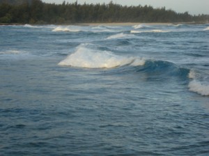
Waves in Turtle Bay, Honolulu |
|
Principal features
|
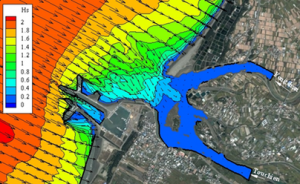
Computed significant wave heights and mean directions in an estuary |
|
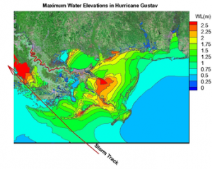
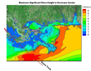
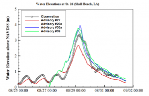
CCHE2D-Coast has been applied to simulate storm surges in the northern Gulf coast. A CCHE2D non-orthogonal mesh with a total of 2.3 million nodes was used to model the topography and bathymetry of oceans, coasts, rivers, structures, roads, and lands in the region. Because of advanced implicit numerical schemes developed for CCHE2D, this storm surge model allows users to adopt a large time step size (e.g. 120 seconds) to compute the hydrodynamic processes in hurricanes. Using a standard desktop PC, CCHE2D-Coast achieved real-time predictions of winds and storm surges in Hurricane Isaac (2012). |
|
|
|
PREDICTION OF HURRICANE ISSAC (2012) CCHE2D-Coast has been used to predict Hurricane Issac (2012) and the predicted results agreed well with the observations. |
|

